CALL US NOW 0406 896 496
Aerial Mapping Products

OUR HIGH-TECH PRODUCTS
At DroneOp, we’re changing the world of construction for good with our high-tech products. We are able to help architects streamline their processes by obtaining the data they require quickly and providing them with the most accurate results. Explore our full list of products below and find out how DroneOp became the number one choice for our customers.
Drone Imagery
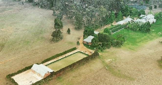
Our drone imagery creates accurate 3D models using photogrammetry. Features of these models can be interrogated to reveal RL’s and coordinates in MGA and AHD. These models are available in all file formats, meaning DroneOp’s drone imagery technology is suitable for all architectural software.
View Analysis Photos

Our drones are able to take view analysis photos from excellent vantage points to portray a site’s proposed view loss and view gain. This photography will help to speed up development approvals by depicting a building’s expected view loss and the potential impact it will have on neighbouring properties. We can also fly our drones to the prospective height and location of the finished building in order to take photos of the view gain that will be achieved upon completion.
Laser Scanning & Point Cloud Surveys
Quickly obtain precise site measurements of buildings and inaccessible objects and infrastructure with our laser scanning technology. DroneOp’s laser technology will scan the site both internally and externally to create a survey-accurate point cloud. Our point cloud surveys offer an extreme level of precision to help architects analyse the site in an accurate and cost-effective manner.
Drone Aerial Mapping
With the assistance of our drone aerial mapping, any architect can utilise the latest in tech for accurate digital imagery for everything from exteriors to interiors. Our methods provide quick results that require a few hours, not a few days, as with other aerial mapping options.
Why use our team when you need aerial surveying companies:
- We’re always happy to answer questions. We understand you might not be familiar with drone surveying and will happily answer any questions you have before you commit to our services.
- Fully CASA licensed. We have a partnership with an established surveying practice in NSW and bring with it a full CASA license.
- Easy to use formats. We ensure that we hand the files to you in an easy-to-use format that doesn’t require special software.
Scenarios Where Aerial Drone Surveying Will Help You
There are a variety of reasons to consider aerial mapping companies for your next project, such as the following:
- You want to save money. Drone mapping takes a fraction of the time compared to traditional, land-based surveys. Using drones also means you need fewer hands-on deck for the job and can focus your resources elsewhere.
- Getting the same files to a group of people. Our services are convenient if you’re dealing with a project where all the involved parties can’t come to the site. We can provide all the overhead mapping and send the files to everyone who needs it.
- In-depth, accurate measurements of a location. Our drones can reach otherwise difficult – or impossible – to reach spaces with traditional surveying methods. This increased reach means you get more accurate information on any survey.
Always remember the name DroneOp when you need reliable surveys for your next big architectural project.