CALL US NOW 0406 896 496
DRONE SURVEYING SERVICES
When it comes to delivering accuracy, our drones are really up there!
Our Platform
Our platform offers users a first-rate experience. All files are able to be downloaded directly from our platform, and survey-accurate point clouds can be interrogated within seconds. You’ll also be able to conduct measurements, cross-sections, and move your cursor over topographical features to get the AHD value with ease.
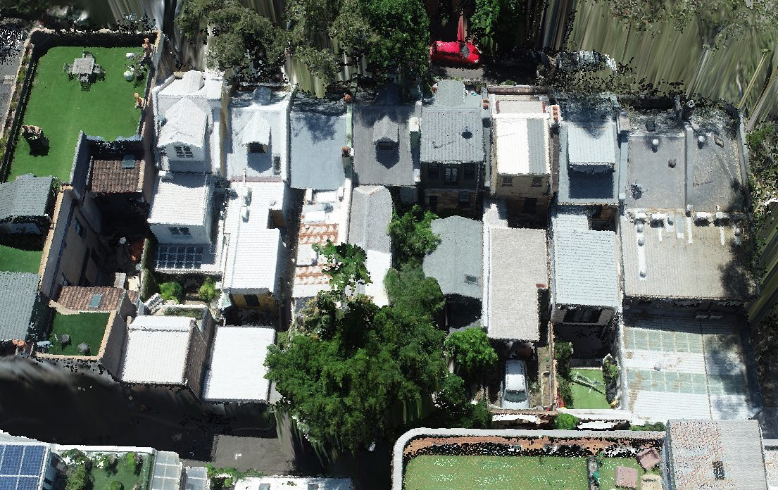
Obtaining Critical Information
When using traditional survey methods, they cannot always be relied upon to capture all of the adjoining property information required for council development application submissions. When you use DroneOp, you can rely on the fact that we’ll obtain accurate information that covers everything the architect needs.
24hr
turnaround time
At DroneOp, we understand the importance of strict time constraints, which is why we guarantee a fast turnaround time. We’ll visit the site, process the data, and have everything ready for the client to view within 24 hours.
Trustworthy Data Verification
We pride ourselves on our results, guaranteeing accuracy every time. All our data is verified by a Registered NSW Surveyor, giving you complete peace of mind when you choose DroneOp.
Welcome to DroneOp!
We deliver accurate data by using the very best mapping, imaging, and modelling technology to provide architects with the accurate results they need. Our state of the art drones and laser scanning technology helps architects to streamline their processes, saving them time and speeding up their projects. By introducing drones into the urban surveying market we have made it faster and easier to capture information that was previously inaccessible when using traditional surveying methods. We are CASA licensed and are partnered with one of the most established surveying practices in NSW. If you’re looking for reliable and accurate survey-based information, DroneOp will guarantee it every time.
Using DroneOp (brands)
DroneOp has been trusted to deliver accurate results to a number of architects and surveyors. We’re proud to work with these companies, offering them quick, accurate results by using the very best technology.


Going Above And Beyond
Drone surveying services have revolutionised the building construction industry. Architects and builders can now access all the site and topographical information they need in a matter of days, rather than the months it took using traditional surveying methods.
We are a leading drone surveying company that offers a vast range of professional services to various industries, including the building and construction industry. We pride ourselves on providing drone construction surveying and 3D mapping of the highest standard, and giving our customers access to detailed, accurate data for their projects. We offer:
- State-of-the-art technology: We make use of the latest advances in highly advanced drone, imaging, mapping, and modelling technology to deliver a service that is superior in every way. We do everything from 3D laser scanning to critical and accurate topographical data.
- Superior service: We pride ourselves on fully understanding the requirements of our customers before taking on a project. Our team is highly experienced in all aspects and requirements of surveying for projects large and small.
- Ease of access: Our customers can access all their data via our state-of-the-art online platform. All your files can be directly downloaded from the platform. We also offer technologically advanced solutions such as topographical readings and much more.
There is only one team to call when you are looking for professional drone surveying services.
Request A Demo
Find out what puts DroneOp above the rest and request a demo to see us in action! Simply fill out our request form and we’ll be in touch to set up a demonstration at a time that works for you.